Sacred India
Kedarnath — the walk, the shrine, and the 2013 flood
A stone shrine at 3,580 metres that has to be walked to, closed by snow for six months, and rebuilt around after a catastrophe.
The short answer
Kedarnath is one of the twelve Jyotirlingas and one of the four Char Dham shrines of Uttarakhand, at about 3,580 metres. It opens from roughly late April or early May to late October or November, and is reached by a walk of about 16 kilometres from Gaurikund.
Key facts
- The deity
- Shiva as Kedarnath; one of the twelve Jyotirlingas and one of the Panch Kedar
- Altitude
- About 3,580 m (11,750 ft)
- Season
- Opens around Akshaya Tritiya in late April or early May; closes around Bhai Dooj after Diwali. Dates are announced annually
- The approach
- About 16 km on foot from Gaurikund; ponies, palanquins and helicopters available
Before you go
- altitude
- Acute mountain sickness is a real risk. Ascend slowly, hydrate, and do not fly straight in and walk hard on the same day
- registration
- Char Dham registration is required and is done online or at counters; carry the confirmation
- weather
- Conditions change within hours. Rain and cold at any time in season; helicopter services stop without notice
- what to carry
- Warm layers, waterproofs, cash, ID, any regular medication, and a torch
Timings and rules at living temples change, and are set by the temple, not by us. Check with the temple before travelling.
What it is
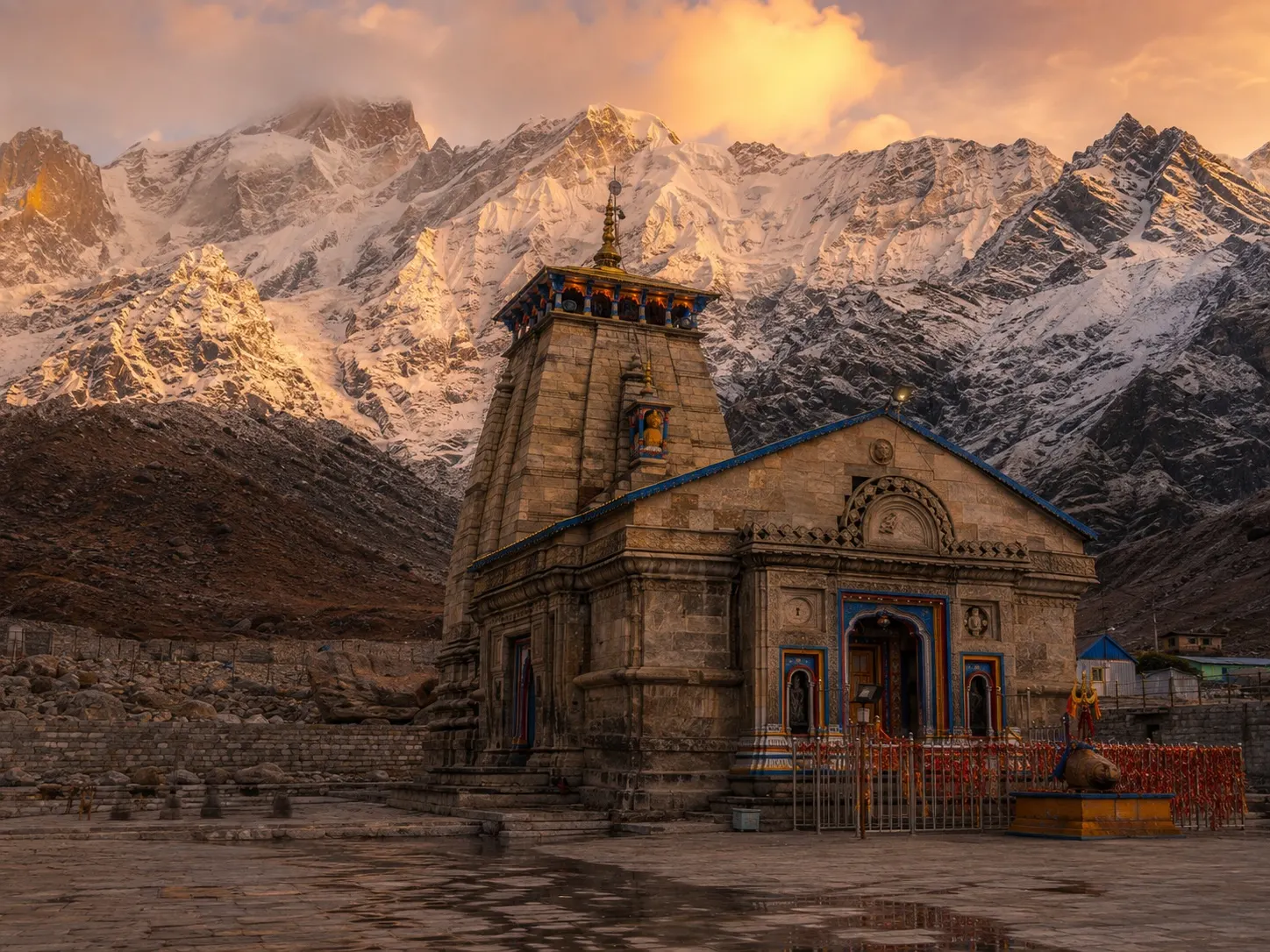
A grey stone temple standing alone in a high valley below the Kedarnath peak, built of large interlocking blocks, with a Nandi facing the entrance and glaciers above.
It is one of the twelve Jyotirlingas — the shrines where Shiva is held to have appeared as a column of light — and one of the four Char Dham shrines of Uttarakhand, which are visited in sequence by pilgrims through the summer.
The building is old; the usual attribution is to the eighth century and to Adi Shankara, with the surviving structure generally dated later. It has stood through an extended period of glaciation and the 2013 flood.
The season, and why it exists
The shrine closes for winter. Around Bhai Dooj in the autumn the deity is carried down to Ukhimath, where worship continues for six months, and the temple is shut under snow. It reopens around Akshaya Tritiya in spring and the deity is carried back up.
This is not a formality. The valley is under deep snow, and until the path is cleared there is no access.
The walk
From Gaurikund, about sixteen kilometres, climbing steadily. In season the path is crowded, with tea stalls, pony traffic and a constant stream of people walking up and down.
Options for those who cannot walk it: ponies and pithoo carriers, palanquins, and helicopters from the valley below. All of them are booked out at peak times and all of them are weather-dependent.
Altitude is the real hazard. Three and a half thousand metres is enough to cause serious mountain sickness in people who arrive too fast, and the combination of a helicopter flight and an immediate walk is exactly the wrong profile.
After 2013
In June 2013, days of extreme rain culminating in a glacial lake outburst sent water, mud and boulders down the valley. Much of the settlement around the temple was destroyed and the death toll across Uttarakhand ran into the thousands. The temple survived; a large boulder lodged behind it is locally held to have split the flow, and is known as the Bhim Shila.
What changed since: rebuilt and rerouted paths, restrictions and registration for Char Dham pilgrims, better weather monitoring, and a substantial reconstruction programme around the shrine.
What did not change: the fundamental exposure of a narrow Himalayan valley to extreme rainfall in a warming climate. Anyone going should treat official advisories as binding rather than cautious.
How this changes across the Char Dham
| Shrine | What differs |
|---|---|
| Yamunotri | The hardest short walk — about 6 km from Janki Chatti, steep; hot springs at the shrine where rice is cooked as offering. |
| Gangotri | Road access to the temple itself; the actual glacier source at Gaumukh is a further trek of about 18 km. |
| Kedarnath | The longest walk of the four, the highest of the temples, and the most weather-exposed. |
| Badrinath | Road access, Vishnu rather than Shiva, and the Tapt Kund hot spring beside the temple; the easiest of the four to visit. |
Questions people ask
How hard is the walk?
Long rather than technical — around 16 kilometres, climbing steadily, on a made path that is crowded in season. Fit walkers manage it in six to eight hours. The difficulty is altitude and weather rather than terrain, and it is a serious undertaking for anyone with a heart or lung condition.
What happened in 2013?
In June 2013, extreme rainfall and a glacial lake outburst sent a torrent through the valley. Thousands of people died across Uttarakhand and much of Kedarnath town was destroyed. The temple itself survived, protected in part by a large boulder that diverted the flow, which is locally known as the Bhim Shila.
Is it safe now?
The approach has been rebuilt with more resilient paths and better communication, and registration limits and weather monitoring are stricter. It remains a high-altitude Himalayan valley in a monsoon-affected range, and that risk cannot be engineered away. Follow official advisories rather than tour operators' assurances.
Can I fly in?
Helicopter services run from Phata, Sersi and Guptkashi in season and are heavily booked. They also cancel frequently for weather, and arriving at altitude by air without acclimatisation raises the risk of mountain sickness.
Sources (3)
- Uttarakhand State Disaster Management Authority reports on the June 2013 disaster — For the sequence of events and the death toll
- Badrinath Kedarnath Temple Committee announcements — For annual opening and closing dates
- Śiva Purāṇa, Koṭirudra Saṃhitā — For the Jyotirlinga tradition and the Kedarnath narrative
Fact-checked by Ajay Gupta on 7 September 2026.
Something wrong here? Tell us — corrections are made in the open, and our editorial standards set out what checking a page involves.